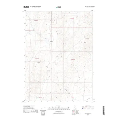
2018 Map of New York Peak
USGS Topo · Published 2018About this map
New York Peak and the high ridges of the Pine Forest Range define this high-desert landscape in northern Humboldt County. This 2018 survey documents a region defined by its vital water sources, where isolated points like Josie Pearl Spring, Willow Spring, and Lone Meadow Spring served as essential landmarks for movement through the Great Basin. The terrain transitions from the high elevations of the Black Rock Range down to the alluvial reaches of Cove Meadows and the drainage of Craine Cr.
Find a feature on this map
30 named features on this map. Tap any name to fly to it.
Don’t see what you’re looking for? This feature index may not catch every label — zoom into the map to look around manually.
Map Details
Editions of this 2018 New York Peak Map
This is the sole edition of this map. No revisions or reprints were ever made.
Other maps of this area

1886 · Disaster
USGS Topo · 1:250,000

1893 · Disaster
USGS Topo · 1:250,000

1954 · Vya
USGS Topo · 1:250,000

1958 · Vya
USGS Topo · 1:250,000

1962 · Vya
USGS Topo · 1:250,000

1965 · Idaho Canyon
USGS Topo · 1:62,500

1965 · Duffer Peak
USGS Topo · 1:62,500

1972 · Burnt Springs
USGS Topo · 1:24,000

1972 · Leonard Cr. Slough North
USGS Topo · 1:24,000
1972 · Battle Creek Ranch
USGS Topo · 1:24,000