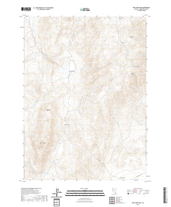
2021 Map of New York Peak
USGS Topo · Published 2021About this map
New York Peak and the surrounding high desert of Humboldt County are defined by a complex network of seasonal water sources and canyons within the Pine Forest Range and Black Rock Range. This landscape reveals a history of resource management in an arid environment, where isolated landmarks like Josie Pearl Spring and Bone Meadow Spring provided essential hydration for cattle and travelers alike. The map traces the rugged path of Pearl Canyon and the wide expanse of Cove Meadows, illustrating the difficult terrain that early settlers and ranchers navigated. Key routes such as Pearl Camp Rd and Leonard Creek Rd connect these remote points, while features like Rodeo Flat suggest the area's long-standing connection to Nevada's ranching traditions. The drainage patterns of Craine Cr and Bartlett Cr further highlight the natural geography that shaped the settlement of this part of the Great Basin.
Find a feature on this map
30 named features on this map. Tap any name to fly to it.
Don’t see what you’re looking for? This feature index may not catch every label — zoom into the map to look around manually.
Map Details
Editions of this 2021 New York Peak Map
This is the sole edition of this map. No revisions or reprints were ever made.
Other maps of this area

1886 · Disaster
USGS Topo · 1:250,000

1893 · Disaster
USGS Topo · 1:250,000

1954 · Vya
USGS Topo · 1:250,000

1958 · Vya
USGS Topo · 1:250,000

1962 · Vya
USGS Topo · 1:250,000

1965 · Idaho Canyon
USGS Topo · 1:62,500

1965 · Duffer Peak
USGS Topo · 1:62,500

1972 · Burnt Springs
USGS Topo · 1:24,000

1972 · Leonard Cr. Slough North
USGS Topo · 1:24,000
1972 · Battle Creek Ranch
USGS Topo · 1:24,000