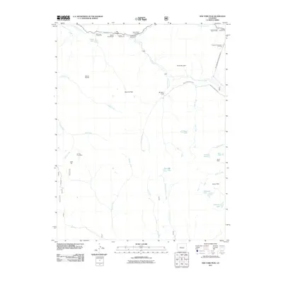
2011 Map of New York Peak
USGS Topo · Published 2011About this map
The Roaring Fork River cuts through this high-altitude landscape in Pitkin County, characterized by a complex network of alpine lakes and water management infrastructure. Engineers shaped this terrain with the Twin Lakes Reservoir Tunnel Number 2 and the New York Collection Canal, directing the flow of glacial runoff across the continental divide. Near the northern margin, the Devils Punchbowl and The Grottos define the river's path, supported by recreational sites like the Weller Lake Campground and Lost Man Campground. Mining history is preserved in the upper elevations at the Independence Number One Mine and the Gold Hill Tunnel Mine near Gold Hill. Numerous high-country basins hold isolated water bodies such as Ptarmigan Lake, Petroleum Lake, and Tabor Lake, surrounded by peaks including New York Peak and Truro Peak.
Find a feature on this map
39 named features on this map. Tap any name to fly to it.
Don’t see what you’re looking for? This feature index may not catch every label — zoom into the map to look around manually.
Map Details
Editions of this 2011 New York Peak Map
This is the sole edition of this map. No revisions or reprints were ever made.
Other maps of this area

1888 · Crested Butte
USGS Topo · 1:62,500

1889 · Crested Butte
USGS Topo · 1:62,500

1893 · Crested Butte
USGS Topo · 1:62,500

1893 · Aspen
USGS Topo · 1:62,500

1895 · Aspen
USGS Topo · 1:62,500

1909 · Mount Jackson
USGS Topo · 1:125,000

1911 · Mount Jackson
USGS Topo · 1:125,000

1934 · Taylor Park
USGS Topo · 1:62,500

1937 · Taylor Park
USGS Topo · 1:62,500

1956 · Montrose
USGS Topo · 1:250,000