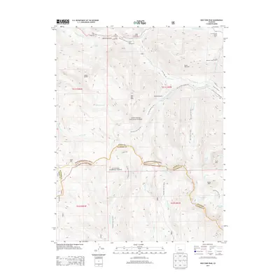
2013 Map of New York Peak
USGS Topo · Published 2013About this map
New York Peak stands as a central landmark in this high-altitude landscape where the boundaries of White River National Forest and Gunnison National Forest meet along the ridge lines of Pitkin and Gunnison Counties. The northern portion of the map follows the corridor of the Roaring Fork River, a hub for early forest recreation and management as evidenced by the Weller Lake Campground, Grottos Campground, and the Lost Man Forest Service Facility. A sophisticated network of water management features is visible, including the New York Collection Canal and the Twin Lakes Reservoir Tunnel Number 2, which reflect the region's history of trans-mountain water diversion. Geological curiosities like The Grottos and the Devils Punchbowl near the Roaring Fork River suggest a landscape shaped by powerful glacial and fluvial forces, while numerous trails such as New York Creek Trail 2182.1 and Ptarmigan Lake Trail 9594.0 provide access to the high basins of Brooklyn Gulch and the peaks beyond.
Find a feature on this map
50 named features on this map. Tap any name to fly to it.
Don’t see what you’re looking for? This feature index may not catch every label — zoom into the map to look around manually.
Map Details
Editions of this 2013 New York Peak Map
This is the sole edition of this map. No revisions or reprints were ever made.
Other maps of this area

1888 · Crested Butte
USGS Topo · 1:62,500

1889 · Crested Butte
USGS Topo · 1:62,500

1893 · Crested Butte
USGS Topo · 1:62,500

1893 · Aspen
USGS Topo · 1:62,500

1895 · Aspen
USGS Topo · 1:62,500

1909 · Mount Jackson
USGS Topo · 1:125,000

1911 · Mount Jackson
USGS Topo · 1:125,000

1934 · Taylor Park
USGS Topo · 1:62,500

1937 · Taylor Park
USGS Topo · 1:62,500

1956 · Montrose
USGS Topo · 1:250,000