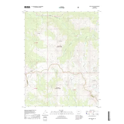
2019 Map of New York Peak
USGS Topo · Published 2019About this map
New York Peak and the high alpine divide of the Elk Mountains dominate this 2019 survey, where the boundary between White River National Forest and Gunnison National Forest traces the jagged ridgelines. The landscape is defined by its dramatic hydrography, featuring high-altitude basins like Tabor Lake, Truro Lake, and Petroleum Lake. The northern reaches of the map follow the Roaring Fork River corridor along Highway 82, passing through the unique geological formations of the Grottos and the Devils Punchbowl. An intriguing element of human engineering, the New York Collection Canal, cuts across the eastern slopes of Green Mtn, reflecting the complex water management history of this high-country environment. From the depths of Brooklyn Gulch to the summit of Truro Peak, the map documents a wilderness shaped by both natural forces and critical alpine watersheds.
Find a feature on this map
38 named features on this map. Tap any name to fly to it.
Don’t see what you’re looking for? This feature index may not catch every label — zoom into the map to look around manually.
Map Details
Editions of this 2019 New York Peak Map
This is the sole edition of this map. No revisions or reprints were ever made.
Other maps of this area

1888 · Crested Butte
USGS Topo · 1:62,500

1889 · Crested Butte
USGS Topo · 1:62,500

1893 · Crested Butte
USGS Topo · 1:62,500

1893 · Aspen
USGS Topo · 1:62,500

1895 · Aspen
USGS Topo · 1:62,500

1909 · Mount Jackson
USGS Topo · 1:125,000

1911 · Mount Jackson
USGS Topo · 1:125,000

1934 · Taylor Park
USGS Topo · 1:62,500

1937 · Taylor Park
USGS Topo · 1:62,500

1956 · Montrose
USGS Topo · 1:250,000