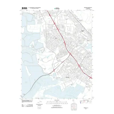
2012 Map of Newark
USGS Topo · Published 2012About this map
Newark and Union City anchor this 2012 survey of the East Bay shoreline, where industrial infrastructure meets complex tidal marshlands. The landscape is defined by the winding paths of Alameda Creek and Newark Slough, alongside prominent geographic features like the Coyote Hills and Red Hill. Historic settlement patterns are visible through localized named areas such as Baumberg, Mattos, and Pabrico. This era of the South Bay is characterized by massive engineering projects like the Hetch Hetchy Aqueduct and the Dumbarton Bridge, which span the transition from urban development to the Pacific Ocean margin. Genealogists and local historians can trace specific landmarks like the Chapel of the Chimes Memorial Park and Holy Ghost Cem, while the names Jarvis Landing and Mowry Landing recall the area's maritime heritage.
Find a feature on this map
33 named features on this map. Tap any name to fly to it.
Don’t see what you’re looking for? This feature index may not catch every label — zoom into the map to look around manually.
Map Details
Editions of this 2012 Newark Map
This is the sole edition of this map. No revisions or reprints were ever made.
Other maps of this area

1889 · San Jose
USGS Topo · 1:62,500

1897 · San Jose
USGS Topo · 1:62,500

1897 · Palo Alto
USGS Topo · 1:62,500

1899 · San Jose
USGS Topo · 1:62,500

1899 · Palo Alto
USGS Topo · 1:62,500

1899 · Haywards
USGS Topo · 1:62,500

1902 · Santa Cruz
USGS Topo · 1:125,000

1906 · Pleasanton
USGS Topo · 1:62,500

1915 · Haywards
USGS Topo · 1:62,500

1941 · Pleasanton
USGS Topo · 1:62,500