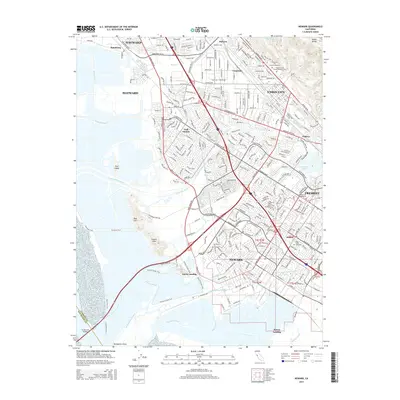
2015 Map of Newark
USGS Topo · Published 2015About this map
Newark and the surrounding Tri-City area are defined by the meeting of East Bay industrial development and the natural marshlands of the San Francisco Bay. This 2015 survey reveals a landscape where modern infrastructure, like the Hetch Hetchy Aqueduct and Dumbarton Bridge, intersects with the remnants of earlier coastal industry at Jarvis Landing and Mowry Landing. The interior shows dense suburban growth within Union City and Fremont, yet older place names like Hall Station, Baumberg, and Pabrico persist as geographic markers of the area's history.
Find a feature on this map
71 named features on this map. Tap any name to fly to it.
Don’t see what you’re looking for? This feature index may not catch every label — zoom into the map to look around manually.
Map Details
Editions of this 2015 Newark Map
This is the sole edition of this map. No revisions or reprints were ever made.
Other maps of this area

1889 · San Jose
USGS Topo · 1:62,500

1897 · San Jose
USGS Topo · 1:62,500

1897 · Palo Alto
USGS Topo · 1:62,500

1899 · San Jose
USGS Topo · 1:62,500

1899 · Palo Alto
USGS Topo · 1:62,500

1899 · Haywards
USGS Topo · 1:62,500

1902 · Santa Cruz
USGS Topo · 1:125,000

1906 · Pleasanton
USGS Topo · 1:62,500

1915 · Haywards
USGS Topo · 1:62,500

1941 · Pleasanton
USGS Topo · 1:62,500