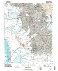
2021 Map of Newark
USGS Topo · Published 2021About this map
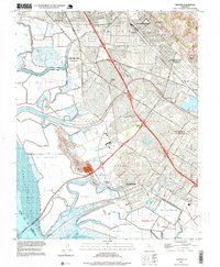
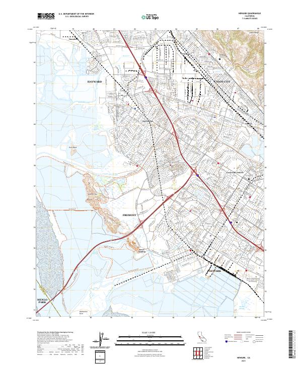
The salt marshes and suburban corridors of southern Alameda County are detailed in this modern survey, defined by the complex interface between the San Francisco Bay shoreline and the sprawling residential developments of Newark, Fremont, and Union City. The industrial and maritime legacy of the East Bay remains visible through features like Jarvis Landing and the Hetch Hetchy Aqueduct, which cuts across the marshlands near Newark Slough. The landscape transitions from the preserved open space of the Coyote Hills and Turk Island to the densely plotted streets of the Centerville District. Genealogy and local history researchers can identify established community landmarks such as the Presbyterian Cem and Holy Spirit Cem, alongside modern institutions like the Ohlone College Newark Center Health Sciences and Technology. Smaller historical nodes like Pabrico, Hall Station, and Baumberg provide points of reference for the region's long-term urbanization.
Find a feature on this map
53 named features on this map. Tap any name to fly to it.
Don’t see what you’re looking for? This feature index may not catch every label — zoom into the map to look around manually.
Map Details
Editions of this 2021 Newark Map
This is the sole edition of this map. No revisions or reprints were ever made.
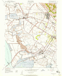
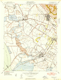
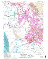
Historical Maps of Mowry Landing Through Time
6 maps found