
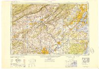
1949 Map of Newark
USGS Topo · Published 1949About this map
The Delaware River serves as the central artery for this post-war landscape, dividing the industrial corridors of New Jersey and Pennsylvania. This regional overview captures a critical moment in American infrastructure as the New Jersey Turnpike and Pennsylvania Turnpike began to reshape transit between the major hubs of New York, Philadelphia, and Newark. The map reveals the intense concentration of rail lines including the Pennsylvania Railroad and Lehigh Valley Railroad, which fueled the manufacturing dominance of cities like Bethlehem and Reading.
Find a feature on this map
198 named features on this map. Tap any name to fly to it.
Don’t see what you’re looking for? This feature index may not catch every label — zoom into the map to look around manually.
Map Details
Editions of this 1949 Newark Map
2 editions found
Other maps of this area

1884 · Whitings
USGS Topo · 1:62,500

1888 · Franklin
USGS Topo · 1:62,500

1888 · Plainfield
USGS Topo · 1:62,500

1888 · Bordentown
USGS Topo · 1:62,500

1888 · Pemberton
USGS Topo · 1:62,500

1888 · Barnegat
USGS Topo · 1:62,500

1888 · Morristown
USGS Topo · 1:62,500

1888 · Hackettstown
USGS Topo · 1:62,500

1888 · New Brunswick
USGS Topo · 1:62,500

1888 · Mount Holly
USGS Topo · 1:62,500