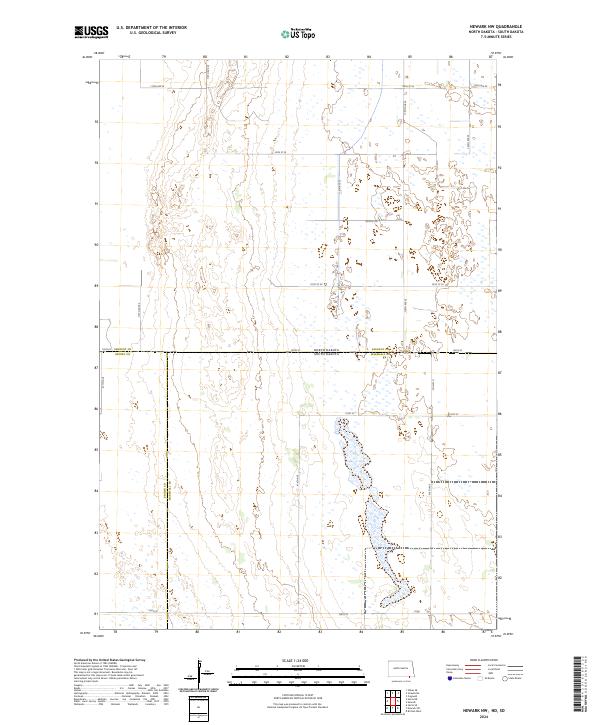
2024 Map of Newark NW
USGS Topo · Published 2024About this map
The state line between North Dakota and South Dakota bisects this prairie landscape, where the intersection of four counties—Sargent Co, Brown Co, and Marshall Co—creates a complex jurisdictional boundary. The terrain is defined by an extensive network of wetlands and seasonal water bodies that follow a north-south orientation, particularly concentrated in the eastern sections. This 2024 survey illustrates a highly structured section-line road system, including 100th St and Co Hwy 11, which serve the agricultural parcels of T129N R58W and T128N R59W. The mapping of these low-lying marshlands alongside the rigid Public Land Survey System grid provides a clear picture of how historical land division persists across the contemporary natural drainage patterns of the Dakotas.
Find a feature on this map
25 named features on this map. Tap any name to fly to it.
Don’t see what you’re looking for? This feature index may not catch every label — zoom into the map to look around manually.
Map Details
Editions of this 2024 Newark NW Map
This is the sole edition of this map. No revisions or reprints were ever made.
Other maps of this area

1894 · Hecla
USGS Topo · 1:62,500

1894 · Oakes
USGS Topo · 1:62,500

1895 · Lamoure
USGS Topo · 1:125,000

1896 · Columbia
USGS Topo · 1:125,000

1918 · La Moure
USGS Topo · 1:125,000

1953 · Jamestown
USGS Topo · 1:250,000

1953 · Hecla SE
USGS Topo · 1:24,000

1953 · Newark SW
USGS Topo · 1:24,000

1953 · Newark
USGS Topo · 1:24,000

1953 · Milbank
USGS Topo · 1:250,000