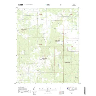
2021 Map of Newburg
USGS Topo · Published 2021About this map
Newburg and Oak Grove anchor this 2021 study of the Franklin County landscape, where the northern agricultural reaches transition into the heavily wooded valleys of the William B. Bankhead National Forest. This modern survey highlights a high density of family and community burial grounds, including the Sylvester Cem, Mount Pleasant Cem, and Macedonia Cem, which serve as vital markers for genealogical research.
Find a feature on this map
85 named features on this map. Tap any name to fly to it.
Don’t see what you’re looking for? This feature index may not catch every label — zoom into the map to look around manually.
Map Details
Editions of this 2021 Newburg Map
This is the sole edition of this map. No revisions or reprints were ever made.
Other maps of this area

1924 · Tuscumbia
USGS Topo · 1:48,000

1926 · Tuscumbia
USGS Topo · 1:62,500

1936 · Russellville
USGS Topo · 1:24,000

1936 · Newburg
USGS Topo · 1:24,000

1936 · Kinlock Spring
USGS Topo · 1:24,000

1936 · Phil Campbell
USGS Topo · 1:24,000

1936 · Moulton
USGS Topo · 1:48,000

1936 · Spruce Pine
USGS Topo · 1:24,000

1936 · Hatton
USGS Topo · 1:24,000

1936 · Landersville
USGS Topo · 1:24,000