
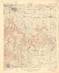
1926 Map of Tuscumbia
USGS Topo · Published 1926About this map
Tuscumbia and Russellville anchor this mid-1920s survey, showing the agricultural and industrial landscape of Northwest Alabama just before the transformative Tennessee Valley Authority projects. The northern border follows the Tennessee River past Sevenmile Island, while the southern reaches rise into the Kent Mountains and Lagrange Mtn. This era is characterized by a dense network of local schools and churches, such as Mt Moriah School and Valley Grove Church, illustrating the importance of community hubs in a rural economy. The Southern railroad and the Northern Alabama tracks define the transportation corridors through Leighton and Spring Valley. Notable family-named landmarks like the Bickley Place and Campbell Settlement provide specific clues for genealogists tracking local ancestry. The map also records early infrastructure like Clements Mill and numerous springs, including Ligon Springs, which were vital for the region's scattered homesteads.
Find a feature on this map
80 named features on this map. Tap any name to fly to it.
Don’t see what you’re looking for? This feature index may not catch every label — zoom into the map to look around manually.
Map Details
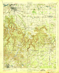
Editions of this 1926 Tuscumbia Map
3 editions found
Other maps of this area

1914 · Rogersville
USGS Topo · 1:48,000

1914 · Muscle Shoals
USGS Topo · 1:48,000

1916 · Muscle Shoals
USGS Topo · 1:62,500

1916 · Rogersville
USGS Topo · 1:62,500

1924 · Tuscumbia
USGS Topo · 1:48,000

1924 · Gravelly Springs
USGS Topo · 1:48,000

1925 · Barton
USGS Topo · 1:62,500

1926 · Barton
USGS Topo · 1:48,000

1926 · Gravelly Springs
USGS Topo · 1:62,500

1929 · Barton
USGS Topo · 1:62,500