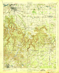
1926 Map of Tuscumbia
USGS Topo · Published 1926About this map
Tuscumbia and Russellville anchor this 1920s landscape, which transitions from the industrial activity near the Tennessee River at Sheffield to the upland terrain of the Kent Mountains. This era shows a dense network of rural infrastructure, including dozens of country schools such as Melrose School, Hackberry School, and Old Bethlehem School. The Southern railroad provides the primary east-west corridor through Leighton, while the Alabama Northern Highway connects the region's smaller agrarian hubs like Spring Valley and Littleville.
Find a feature on this map
74 named features on this map. Tap any name to fly to it.
Don’t see what you’re looking for? This feature index may not catch every label — zoom into the map to look around manually.
Map Details
Editions of this 1926 Tuscumbia Map
3 editions found
Other maps of this area

1914 · Rogersville
USGS Topo · 1:48,000

1914 · Muscle Shoals
USGS Topo · 1:48,000

1916 · Muscle Shoals
USGS Topo · 1:62,500

1916 · Rogersville
USGS Topo · 1:62,500

1924 · Tuscumbia
USGS Topo · 1:48,000

1924 · Gravelly Springs
USGS Topo · 1:48,000

1925 · Barton
USGS Topo · 1:62,500

1926 · Tuscumbia
USGS Topo · 1:62,500

1926 · Barton
USGS Topo · 1:48,000

1926 · Gravelly Springs
USGS Topo · 1:62,500