
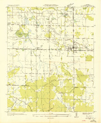
1936 Map of Hatton
USGS Topo · Published 1936About this map
Hatton and the surrounding rural landscape of Lawrence County are captured here during a period of detailed field examination by the Tennessee Valley Authority. The settlement pattern is defined by a dense network of country schools and churches, such as Beavers Cross Sch, Oak Grove Sch, and Okalona Ch, which served as the social anchors for this agricultural community. The terrain transitions from the broader valley floor into the rising Mountain area to the east, with drainage provided by meandering waterways like Town Creek and Crooked Creek.
Find a feature on this map
43 named features on this map. Tap any name to fly to it.
Don’t see what you’re looking for? This feature index may not catch every label — zoom into the map to look around manually.
Map Details
Editions of this 1936 Hatton Map
This is the sole edition of this map. No revisions or reprints were ever made.
Other maps of this area

1924 · Tuscumbia
USGS Topo · 1:48,000

1926 · Tuscumbia
USGS Topo · 1:62,500

1935 · Moulton
USGS Topo · 1:24,000

1936 · Newburg
USGS Topo · 1:24,000

1936 · Courtland
USGS Topo · 1:24,000

1936 · Moulton
USGS Topo · 1:48,000

1936 · Town Creek
USGS Topo · 1:24,000
1936 · Leighton
USGS Topo · 1:24,000

1936 · Masterson
USGS Topo · 1:24,000

1936 · Landersville
USGS Topo · 1:24,000