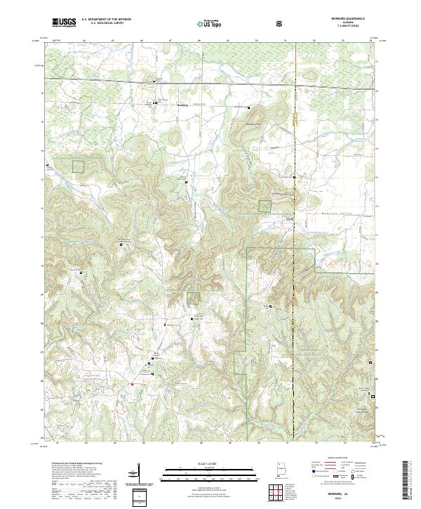
2024 Map of Newburg
USGS Topo · Published 2024About this map
Newburg sits at a crossroads of high ridges and narrow valleys along the Franklin and Lawrence County line. This landscape is defined by the Tennessee Valley Divide and the rugged drainage basins of Little Bear Creek and Cedar Creek. Much of the southern and central portion is occupied by the William B. Bankhead National Forest, where the terrain drops into steep features like Coffin Hollow, Denton Hollow, and Stillhouse Hollow. Genealogists will find a wealth of local landmarks, including over a dozen burial sites such as Macedonia Cem, Kimbroughs Chapel Cem, and the Byler Ridge Road Cem. The map illustrates a rural interior where winding routes like Old State Rte 24 and Russellville Rd connect isolated homesteads and country churches, providing a clear record of the area's contemporary settlement patterns and topography.
Find a feature on this map
91 named features on this map. Tap any name to fly to it.
Don’t see what you’re looking for? This feature index may not catch every label — zoom into the map to look around manually.
Map Details
Editions of this 2024 Newburg Map
This is the sole edition of this map. No revisions or reprints were ever made.
Other maps of this area

1924 · Tuscumbia
USGS Topo · 1:48,000

1926 · Tuscumbia
USGS Topo · 1:62,500

1936 · Russellville
USGS Topo · 1:24,000

1936 · Newburg
USGS Topo · 1:24,000

1936 · Kinlock Spring
USGS Topo · 1:24,000

1936 · Phil Campbell
USGS Topo · 1:24,000

1936 · Moulton
USGS Topo · 1:48,000

1936 · Spruce Pine
USGS Topo · 1:24,000

1936 · Hatton
USGS Topo · 1:24,000

1936 · Landersville
USGS Topo · 1:24,000