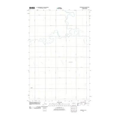
2011 Map of Newburg SE
USGS Topo · Published 2011About this map
Deep River meanders across the northern portion of this McHenry County landscape, joined by the winding course of Cut Bank Creek as it flows through the sectioned agricultural plains. The terrain is defined by a rigid grid of rural roads, including 10th Ave N and 81st St N, reflecting the systematic settlement patterns of the North Dakota prairie. Cultural landmarks are sparse but significant for local history, including Fredericks Cemetery situated in the central region and Little Deep Cemetery located near the southwestern corner. These sites, along with arterial routes like County Hwy 17, serve as primary identifiers for a landscape dedicated to large-scale farming and quiet rural life in the early twenty-first century.
Find a feature on this map
19 named features on this map. Tap any name to fly to it.
Don’t see what you’re looking for? This feature index may not catch every label — zoom into the map to look around manually.
Map Details
Editions of this 2011 Newburg SE Map
This is the sole edition of this map. No revisions or reprints were ever made.
Other maps of this area

1948 · Newburg SW
USGS Topo · 1:24,000

1949 · Granville NE
USGS Topo · 1:24,000

1949 · Newburg SW
USGS Topo · 1:24,000

1949 · Granville NW
USGS Topo · 1:24,000

1949 · Kramer
USGS Topo · 1:24,000

1950 · Newburg
USGS Topo · 1:24,000

1950 · Kramer
USGS Topo · 1:24,000

1950 · Deep
USGS Topo · 1:24,000

1950 · Upham
USGS Topo · 1:24,000

1950 · Newburg SE
USGS Topo · 1:24,000