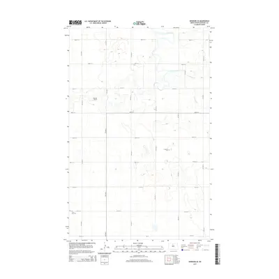
2014 Map of Newburg SE
USGS Topo · Published 2014About this map
Deep River and Cut Bank Creek meander through the prairie landscape of McHenry County, defining the drainage patterns of this rural agricultural region. The terrain is characterized by the low-lying glacial depressions and small potholes typical of the North Dakota plains, with a regular grid of section roads like 80th St N and 12th Ave N providing access to the farmland. Local history and genealogy interests are centered on quiet markers of the past, including Fredericks Cem and Little Deep Cem located in the southern reaches of the map. Small-scale aviation is represented by the Rosenau Airport, while CR-17 provides a primary transit corridor across the southern township line. This 2014 survey documents the enduring rural structure of the Great Plains at the start of the 21st century.
Find a feature on this map
22 named features on this map. Tap any name to fly to it.
Don’t see what you’re looking for? This feature index may not catch every label — zoom into the map to look around manually.
Map Details
Editions of this 2014 Newburg SE Map
This is the sole edition of this map. No revisions or reprints were ever made.
Other maps of this area

1948 · Newburg SW
USGS Topo · 1:24,000

1949 · Granville NE
USGS Topo · 1:24,000

1949 · Newburg SW
USGS Topo · 1:24,000

1949 · Granville NW
USGS Topo · 1:24,000

1949 · Kramer
USGS Topo · 1:24,000

1950 · Newburg
USGS Topo · 1:24,000

1950 · Kramer
USGS Topo · 1:24,000

1950 · Deep
USGS Topo · 1:24,000

1950 · Upham
USGS Topo · 1:24,000

1950 · Newburg SE
USGS Topo · 1:24,000