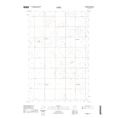
2020 Map of Newburg SE
USGS Topo · Published 2020About this map
Deep River meanders across this McHenry County landscape, defining the hydrology of a region where water and land use are inextricably linked. The terrain is characterized by a grid of agricultural section lines and township boundaries, including t159n r79w and t158n r78w, punctuated by isolated landmarks of local significance. Genealogists will find interest in the three burial grounds noted here—the Rural Cem, Fredericks Cem, and Little Deep Cem—which serve as silent witnesses to the rural families who settled this prairie. Small-scale aviation is represented by the Rosenau Airport, while several watercourses like Cut Bank Creek and Little Deep Creek drain the surrounding fields. The map captures a late twentieth-century persistence of the rural township structure, showing how the landscape is divided between vast open spaces and the essential nodes of transportation and memory.
Find a feature on this map
26 named features on this map. Tap any name to fly to it.
Don’t see what you’re looking for? This feature index may not catch every label — zoom into the map to look around manually.
Map Details
Editions of this 2020 Newburg SE Map
This is the sole edition of this map. No revisions or reprints were ever made.
Other maps of this area

1948 · Newburg SW
USGS Topo · 1:24,000

1949 · Granville NE
USGS Topo · 1:24,000

1949 · Newburg SW
USGS Topo · 1:24,000

1949 · Granville NW
USGS Topo · 1:24,000

1949 · Kramer
USGS Topo · 1:24,000

1950 · Newburg
USGS Topo · 1:24,000

1950 · Kramer
USGS Topo · 1:24,000

1950 · Deep
USGS Topo · 1:24,000

1950 · Upham
USGS Topo · 1:24,000

1950 · Newburg SE
USGS Topo · 1:24,000