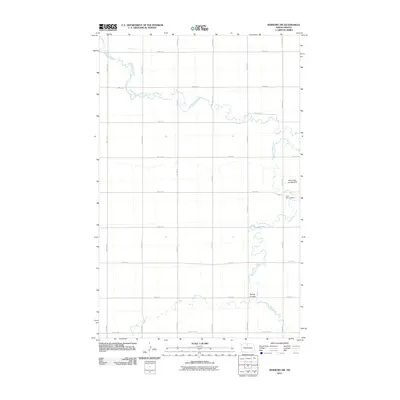
2011 Map of Newburg SW
USGS Topo · Published 2011About this map
Saint Paul Cemetery stands as a quiet landmark in this section of McHenry County, situated near the meandering path of Little Deep Creek. This 2011 survey by the U.S. Geological Survey illustrates the highly organized section-line road network that defines the North Dakota prairie, with routes like 80th St N and 14th Ave N carving a precise grid across the landscape.
Find a feature on this map
20 named features on this map. Tap any name to fly to it.
Don’t see what you’re looking for? This feature index may not catch every label — zoom into the map to look around manually.
Map Details
Editions of this 2011 Newburg SW Map
This is the sole edition of this map. No revisions or reprints were ever made.
Other maps of this area

1948 · Newburg SW
USGS Topo · 1:24,000

1949 · Granville NE
USGS Topo · 1:24,000

1949 · Newburg SW
USGS Topo · 1:24,000

1949 · Granville NW
USGS Topo · 1:24,000

1949 · Eckman SE
USGS Topo · 1:24,000

1949 · Eckman
USGS Topo · 1:24,000

1949 · Deering
USGS Topo · 1:24,000

1950 · Newburg
USGS Topo · 1:24,000
1950 · Deering
USGS Topo · 1:62,500

1950 · Deep
USGS Topo · 1:24,000