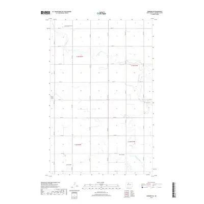
2017 Map of Newburg SW
USGS Topo · Published 2017About this map
Saint Paul Cem sits along the eastern edge of this McHenry County landscape, a quiet landmark in a region defined by its wide agricultural sections and prairie drainages. The terrain is shaped by the meandering courses of Cut Bank Creek and Little Deep Creek, which flow through the northern and southern portions of the map, respectively. These waterways, along with the Spring Coulee, create natural breaks in the rigid grid of rural roads like 16th Ave N and 80th St N. Aviation markers such as the Marsh Brothers Airstrip and Welstad Farms Airstrip highlight the importance of private flight in navigating and managing this expansive North Dakota farmland during the early 21st century.
Find a feature on this map
25 named features on this map. Tap any name to fly to it.
Don’t see what you’re looking for? This feature index may not catch every label — zoom into the map to look around manually.
Map Details
Editions of this 2017 Newburg SW Map
This is the sole edition of this map. No revisions or reprints were ever made.
Other maps of this area

1948 · Newburg SW
USGS Topo · 1:24,000

1949 · Granville NE
USGS Topo · 1:24,000

1949 · Newburg SW
USGS Topo · 1:24,000

1949 · Granville NW
USGS Topo · 1:24,000

1949 · Eckman SE
USGS Topo · 1:24,000

1949 · Eckman
USGS Topo · 1:24,000

1949 · Deering
USGS Topo · 1:24,000

1950 · Newburg
USGS Topo · 1:24,000
1950 · Deering
USGS Topo · 1:62,500

1950 · Deep
USGS Topo · 1:24,000