
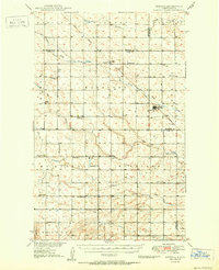
1949 Map of Newburg SW
USGS Topo · Published 1949About this map
The winding course of the Deep River dominates this post-war landscape in McHenry County, where the prairie is etched with the drainage patterns of Spring Coulee and Little Deep Creek. This 1949 survey illustrates a rural social structure anchored by small community centers like the Town Hall and a network of district schools, including two distinct locations labeled School No 1 and School No 2. The presence of the Deep River Ch, St Paul Cem, and Lutheran Cem highlights the importance of faith and lineage in this North Dakota farming region. Land use is organized around township grids, specifically within Pratt and Grilley, where the topography was meticulously documented just before the mid-century to support the development of the Missouri River Basin. The intricate contouring reveals the subtle elevation changes of the coulees and river bottoms that defined life in the Northern Plains during this era.
Find a feature on this map
13 named features on this map. Tap any name to fly to it.
Don’t see what you’re looking for? This feature index may not catch every label — zoom into the map to look around manually.
Map Details
Editions of this 1949 Newburg SW Map
This is the sole edition of this map. No revisions or reprints were ever made.
Other maps of this area

1948 · Newburg SW
USGS Topo · 1:24,000

1949 · Granville NE
USGS Topo · 1:24,000

1949 · Granville NW
USGS Topo · 1:24,000

1949 · Eckman SE
USGS Topo · 1:24,000

1949 · Eckman
USGS Topo · 1:24,000

1949 · Deering
USGS Topo · 1:24,000

1950 · Newburg
USGS Topo · 1:24,000
1950 · Deering
USGS Topo · 1:62,500

1950 · Deep
USGS Topo · 1:24,000

1950 · Newburg SE
USGS Topo · 1:24,000