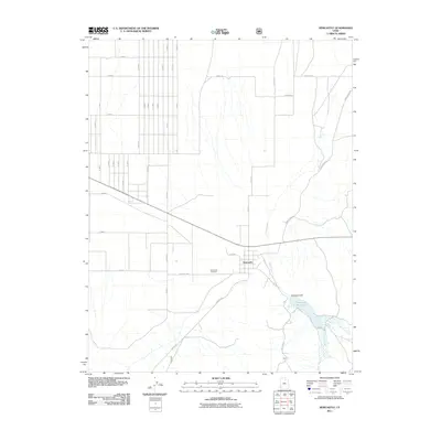
2011 Map of Newcastle
USGS Topo · Published 2011About this map
Newcastle serves as the central hub of this agricultural landscape in Iron County, where a highly organized grid of rural roads, including N 3000 E and E 1600 N, defines the local geography. Water management is the dominant environmental feature, anchored by the Newcastle Reservoir and the Newcastle Dam to the southeast. These structures capture the flow of Pinto Creek and Little Pinto Creek, providing essential irrigation for the surrounding valley. Local history is physically represented at the Newcastle Cemetery, located just west of the town center along Cemetery Rd. The map also traces established routes like Sand Spring Rd and Hulet Rd, which connect the outlying desert and farm tracts to the heart of the settlement at Main St.
Find a feature on this map
40 named features on this map. Tap any name to fly to it.
Don’t see what you’re looking for? This feature index may not catch every label — zoom into the map to look around manually.
Map Details
Editions of this 2011 Newcastle Map
This is the sole edition of this map. No revisions or reprints were ever made.
Other maps of this area

1885 · St. George
USGS Topo · 1:250,000

1891 · St. George
USGS Topo · 1:250,000

1950 · Antelope Peak
USGS Topo · 1:24,000

1950 · Iron Mountain
USGS Topo · 1:62,500

1950 · Silver Peak
USGS Topo · 1:24,000

1950 · Page Ranch
USGS Topo · 1:24,000

1951 · Silver Peak
USGS Topo · 1:24,000

1951 · Page Ranch
USGS Topo · 1:24,000

1953 · Cedar City
USGS Topo · 1:250,000

1958 · Cedar City
USGS Topo · 1:250,000