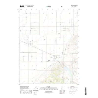
2020 Map of Newcastle
USGS Topo · Published 2020About this map
Newcastle sits at the transition between the arid expanse of the Escalante Valley and the rising slopes of the Dixie National Forest. This 2020 survey illustrates the rigid grid-iron irrigation and settlement patterns that define this corner of the Escalante Desert, where the landscape is starkly divided between geometric agricultural plots and the winding natural drainage of Pinto Cr. For local historians and genealogists, the map provides precise positioning for the Newcastle Cem, located just south of the main residential cluster. To the southeast, the terrain transitions into a more complex topographical environment, where the Newcastle Reservoir collects water from the highlands of the national forest and Little Pinto Cr, supporting the life and industry of the valley below.
Find a feature on this map
11 named features on this map. Tap any name to fly to it.
Don’t see what you’re looking for? This feature index may not catch every label — zoom into the map to look around manually.
Map Details
Editions of this 2020 Newcastle Map
This is the sole edition of this map. No revisions or reprints were ever made.
Other maps of this area

1885 · St. George
USGS Topo · 1:250,000

1891 · St. George
USGS Topo · 1:250,000

1950 · Antelope Peak
USGS Topo · 1:24,000

1950 · Iron Mountain
USGS Topo · 1:62,500

1950 · Silver Peak
USGS Topo · 1:24,000

1950 · Page Ranch
USGS Topo · 1:24,000

1951 · Silver Peak
USGS Topo · 1:24,000

1951 · Page Ranch
USGS Topo · 1:24,000

1953 · Cedar City
USGS Topo · 1:250,000

1958 · Cedar City
USGS Topo · 1:250,000