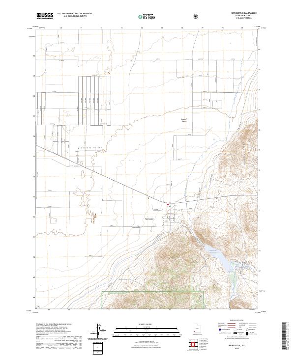
2023 Map of Newcastle
USGS Topo · Published 2023About this map
Newcastle sits at the transition between the wide, arid floor of the Escalante Valley and the rising slopes of the Antelope Range. The community's local history is anchored by the Newcastle Cem, while its agricultural and hydrological life depends on water management from the Newcastle Reservoir. This modern survey reveals how the local road network, including Pinto Canyon Rd and Bench Rd, navigates the complex terrain where the Escalante Desert meets the protected lands of the Dixie National Forest. Drainage patterns from Pinto Creek and Little Pinto Creek are clearly traced as they descend from the highlands toward the valley floor, illustrating the vital relationship between the mountain watersheds and the desert settlements below.
Find a feature on this map
22 named features on this map. Tap any name to fly to it.
Don’t see what you’re looking for? This feature index may not catch every label — zoom into the map to look around manually.
Map Details
Editions of this 2023 Newcastle Map
This is the sole edition of this map. No revisions or reprints were ever made.
Other maps of this area

1885 · St. George
USGS Topo · 1:250,000

1891 · St. George
USGS Topo · 1:250,000

1950 · Antelope Peak
USGS Topo · 1:24,000

1950 · Iron Mountain
USGS Topo · 1:62,500

1950 · Silver Peak
USGS Topo · 1:24,000

1950 · Page Ranch
USGS Topo · 1:24,000

1951 · Silver Peak
USGS Topo · 1:24,000

1951 · Page Ranch
USGS Topo · 1:24,000

1953 · Cedar City
USGS Topo · 1:250,000

1958 · Cedar City
USGS Topo · 1:250,000