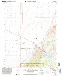
2002 Map of Newcastle
USGS Topo · Published 2005About this map
Escalante Valley dominates the northern half of this landscape, where a grid of wells and irrigation infrastructure speaks to the agricultural development around the settlement of Newcastle. This 2002 revision, based on earlier topographic data and 1998 imagery, shows the community centered near a series of public utilities, including a substation and Pumping Sta. The transition from the flat valley floor to the rising southern highlands is marked by the Dixie National Forest boundary and the Pine Valley Ranger District.
Find a feature on this map
17 named features on this map. Tap any name to fly to it.
Don’t see what you’re looking for? This feature index may not catch every label — zoom into the map to look around manually.
Map Details
Editions of this 2002 Newcastle Map
This is the sole edition of this map. No revisions or reprints were ever made.
Other maps of this area

1885 · St. George
USGS Topo · 1:250,000

1891 · St. George
USGS Topo · 1:250,000

1950 · Antelope Peak
USGS Topo · 1:24,000

1950 · Iron Mountain
USGS Topo · 1:62,500

1950 · Silver Peak
USGS Topo · 1:24,000

1950 · Page Ranch
USGS Topo · 1:24,000

1951 · Silver Peak
USGS Topo · 1:24,000

1951 · Page Ranch
USGS Topo · 1:24,000

1953 · Cedar City
USGS Topo · 1:250,000

1958 · Cedar City
USGS Topo · 1:250,000