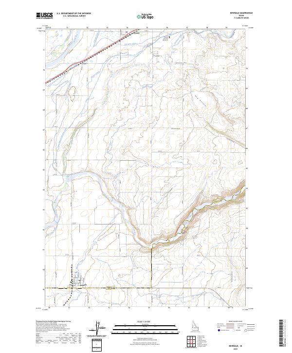
2023 Map of Newdale
USGS Topo · Published 2023About this map
Hydraulic engineering and high-desert agriculture define this portion of the Snake River Plain, where an intricate network of irrigation systems transforms the landscape near the Fremont and Madison County line. The Teton River carves a deep path through the southeastern terrain, while the Henrys Fork and Fall River influence the hydrology of the northern sectors. The reliance on water management is evident in the dense concentration of named waterways, including the Last Chance Canal, Fall River Canal, and the South Branch Fall River Canal, which weave through the agricultural grid serving the communities of Newdale and Chester.
Find a feature on this map
43 named features on this map. Tap any name to fly to it.
Don’t see what you’re looking for? This feature index may not catch every label — zoom into the map to look around manually.
Map Details
Editions of this 2023 Newdale Map
This is the sole edition of this map. No revisions or reprints were ever made.
Other maps of this area

1949 · Newdale
USGS Topo · 1:24,000

1950 · Newdale
USGS Topo · 1:24,000

1950 · St Anthony
USGS Topo · 1:24,000

1951 · Moody
USGS Topo · 1:24,000

1951 · White Owl Butte
USGS Topo · 1:24,000

1955 · Ashton
USGS Topo · 1:250,000

1955 · Driggs
USGS Topo · 1:250,000

1958 · Driggs
USGS Topo · 1:250,000

1958 · Ashton
USGS Topo · 1:250,000

1960 · Ashton
USGS Topo · 1:250,000