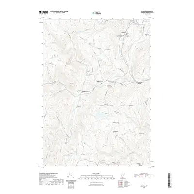
2021 Map of Newfane
USGS Topo · Published 2021About this map
Newfane serves as the focal point of this Windham County landscape, where the West River and Rock River carve through a terrain of prominent peaks like Newfane Hill and Oregon Mtn. The village layout includes the Windham County Court Civil Division, anchoring the local civic life, while the Williamsville Covered Bridge spans the waters to the south near Williamsville. The map is particularly dense with small family and community burial grounds, such as the Perry Family Radway Cem and Cole Brown Cem, which offer significant value for genealogical research into the area's early residents. Settlement patterns follow the river valleys and narrow roads like Dover Rd and Baker Brook Rd, connecting outlying hamlets like South Newfane to the commercial rail corridor at Williamsville Station. Large bodies of water including Sunset Lake and Kenny Pond punctuate the wooded uplands, illustrating the rural character of this Vermont region.
Find a feature on this map
101 named features on this map. Tap any name to fly to it.
Don’t see what you’re looking for? This feature index may not catch every label — zoom into the map to look around manually.
Map Details
Editions of this 2021 Newfane Map
This is the sole edition of this map. No revisions or reprints were ever made.
Other maps of this area

1889 · Wilmington
USGS Topo · 1:62,500

1891 · Wilmington
USGS Topo · 1:62,500

1891 · Brattleboro
USGS Topo · 1:62,500

1893 · Brattleboro
USGS Topo · 1:62,500

1894 · Londonderry
USGS Topo · 1:62,500

1899 · Londonderry
USGS Topo · 1:62,500

1899 · Wilmington
USGS Topo · 1:62,500

1930 · Saxtons River
USGS Topo · 1:48,000

1932 · Brattleboro
USGS Topo · 1:48,000

1933 · Saxtons River
USGS Topo · 1:62,500