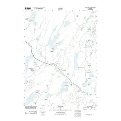
2011 Map of Newfoundland
USGS Topo · Published 2011About this map
The Pequannock River valley defines the central corridor of this Highland landscape, where the settlements of Newfoundland and Oak Ridge served as historical transit points along the water. By the early 21st century, the region's character is shaped by massive water management projects including the Canistear Reservoir, Oak Ridge Reservoir, and Clinton Reservoir, which dominate the western and central terrain. Smaller hamlets like Union Valley and Postville are interspersed among numerous ponds and lakes, while Kanouse Mountain and Copperas Mountain provide significant topographical relief. Genealogists will find interest in the distributed burial sites, from the Saint Joseph's Roman Catholic Cemetery near Macopin to the Turner Cemetery and Vreeland Cemetery. The presence of the Craigmeur Ski Slope near Kitchell points to the area's transition toward a recreation-focused economy.
Find a feature on this map
153 named features on this map. Tap any name to fly to it.
Don’t see what you’re looking for? This feature index may not catch every label — zoom into the map to look around manually.
Map Details
Editions of this 2011 Newfoundland Map
This is the sole edition of this map. No revisions or reprints were ever made.
Other maps of this area

1888 · Franklin
USGS Topo · 1:62,500

1888 · Morristown
USGS Topo · 1:62,500

1888 · Lake Hopatcong
USGS Topo · 1:62,500

1891 · Greenwood Lake
USGS Topo · 1:62,500

1893 · Greenwood Lake
USGS Topo · 1:62,500

1894 · Morristown
USGS Topo · 1:62,500

1894 · Lake Hopatcong
USGS Topo · 1:62,500

1894 · Franklin
USGS Topo · 1:62,500

1897 · Franklin
USGS Topo · 1:62,500

1898 · Lake Hopatcong
USGS Topo · 1:62,500