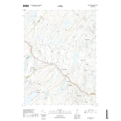
2019 Map of Newfoundland
USGS Topo · Published 2019About this map
Bearfort Mtn and Kanouse Mtn dominate the Highlands landscape of northern New Jersey, framing a region defined by extensive watershed management and early industrial settlements. This 2019 survey captures the complex water system serving the metropolitan area, including the Canistear Reservoir, Clinton Reservoir, and Oak Ridge Reservoir. The Pequannock River winds through the valley, flanked by the NY S & W RR line which historically connected these mountain communities. Local heritage is preserved in several small burial grounds and religious sites, such as the Turner Cem and the Oak Ridge Presbyterian Church, which mark the center of the Oak Ridge settlement. The map highlights the contrast between the densely wooded ridges and the developed clusters at Newfoundland, Macopin, and Kinnelon. Significant elevation changes are evident from the high peaks of Copperas Mtn down to the shores of Echo Lake, illustrating the topographic character of the Passaic, Morris, and Sussex county borders.
Find a feature on this map
163 named features on this map. Tap any name to fly to it.
Don’t see what you’re looking for? This feature index may not catch every label — zoom into the map to look around manually.
Map Details
Editions of this 2019 Newfoundland Map
This is the sole edition of this map. No revisions or reprints were ever made.
Other maps of this area

1888 · Franklin
USGS Topo · 1:62,500

1888 · Morristown
USGS Topo · 1:62,500

1888 · Lake Hopatcong
USGS Topo · 1:62,500

1891 · Greenwood Lake
USGS Topo · 1:62,500

1893 · Greenwood Lake
USGS Topo · 1:62,500

1894 · Morristown
USGS Topo · 1:62,500

1894 · Lake Hopatcong
USGS Topo · 1:62,500

1894 · Franklin
USGS Topo · 1:62,500

1897 · Franklin
USGS Topo · 1:62,500

1898 · Lake Hopatcong
USGS Topo · 1:62,500