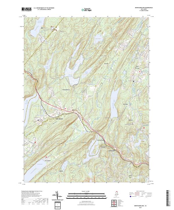
2023 Map of Newfoundland
USGS Topo · Published 2023About this map
The Pequannock River corridor defines this portion of the Highlands, where the massive engineering of the North Jersey water supply system is evident through the Oak Ridge Reservoir, Canistear Reservoir, and Charlotteburg Reservoir. These major impoundments sit alongside long-established settlements like Newfoundland and Oak Ridge, which served as historical focal points for transport and commerce in the region. The map reveals a landscape of high ridges and narrow valleys, including Bearfort Mtn and Kanouse Mtn, which have historically constrained development to the low-lying gaps.
Find a feature on this map
175 named features on this map. Tap any name to fly to it.
Don’t see what you’re looking for? This feature index may not catch every label — zoom into the map to look around manually.
Map Details
Editions of this 2023 Newfoundland Map
This is the sole edition of this map. No revisions or reprints were ever made.
Other maps of this area

1888 · Franklin
USGS Topo · 1:62,500

1888 · Morristown
USGS Topo · 1:62,500

1888 · Lake Hopatcong
USGS Topo · 1:62,500

1891 · Greenwood Lake
USGS Topo · 1:62,500

1893 · Greenwood Lake
USGS Topo · 1:62,500

1894 · Morristown
USGS Topo · 1:62,500

1894 · Lake Hopatcong
USGS Topo · 1:62,500

1894 · Franklin
USGS Topo · 1:62,500

1897 · Franklin
USGS Topo · 1:62,500

1898 · Lake Hopatcong
USGS Topo · 1:62,500