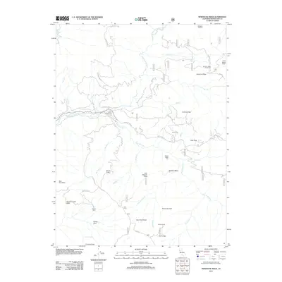
2012 Map of Newhouse Ridge
USGS Topo · Published 2012About this map
McClure Place and Bauer Ranch represent the sparse human footprint within this section of the Mendocino National Forest during the early 21st century. The landscape is defined by the confluence of the Middle Fork Eel River and the Black Butte River, which carve through a series of named elevations including Newhouse Ridge and Billy Williams Ridge. This area serves primarily as a recreational and pastoral corridor, evidenced by the Eel River Campground and the presence of working sites like Johnson Corral and Horse Camp.
Find a feature on this map
60 named features on this map. Tap any name to fly to it.
Don’t see what you’re looking for? This feature index may not catch every label — zoom into the map to look around manually.
Map Details
Editions of this 2012 Newhouse Ridge Map
This is the sole edition of this map. No revisions or reprints were ever made.
Other maps of this area

1926 · Covelo
USGS Topo · 1:62,500

1929 · Eden Valley
USGS Topo · 1:62,500

1952 · Hull Mountain
USGS Topo · 1:62,500

1952 · Eden Valley
USGS Topo · 1:62,500

1952 · Covelo
USGS Topo · 1:62,500

1952 · Anthony Peak
USGS Topo · 1:62,500

1957 · Ukiah
USGS Topo · 1:250,000

1960 · Ukiah
USGS Topo · 1:250,000
1966 · Leech Lake Mountain
USGS Topo · 1:24,000

1967 · Plaskett Ridge
USGS Topo · 1:24,000