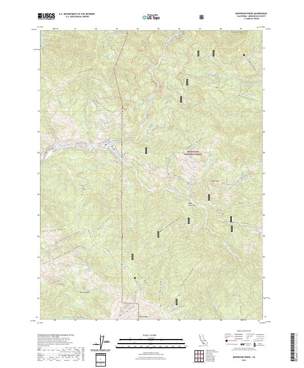
2021 Map of Newhouse Ridge
USGS Topo · Published 2021About this map
Mendocino National Forest encompasses the entirety of this northern California terrain, where the water system is defined by the Eel Wild and Scenic River and its major tributary, the Black Butte Wild and Scenic River. The landscape is a complex network of high-elevation divides, including the namesake Newhouse Ridge and the prominent Anthony Ridge. Transportation through this steep geography relies on established routes such as Forest Highway Seven and the Mendocino Pass Rd, which provide access to localized landmarks like Shake Cabin Flat. This map preserves the 2021 state of a landscape shaped by natural drainage basins, such as Bentley Basin and Hayshed Basin, and notable peaks like Nebo Rock. For researchers and historians, the map documents the modern footprint of remote forest service access, including Indian Dick Rd and various hiking paths like The Falls Trl.
Find a feature on this map
58 named features on this map. Tap any name to fly to it.
Don’t see what you’re looking for? This feature index may not catch every label — zoom into the map to look around manually.
Map Details
Editions of this 2021 Newhouse Ridge Map
This is the sole edition of this map. No revisions or reprints were ever made.
Other maps of this area

1926 · Covelo
USGS Topo · 1:62,500

1929 · Eden Valley
USGS Topo · 1:62,500

1952 · Hull Mountain
USGS Topo · 1:62,500

1952 · Eden Valley
USGS Topo · 1:62,500

1952 · Covelo
USGS Topo · 1:62,500

1952 · Anthony Peak
USGS Topo · 1:62,500

1957 · Ukiah
USGS Topo · 1:250,000

1960 · Ukiah
USGS Topo · 1:250,000
1966 · Leech Lake Mountain
USGS Topo · 1:24,000

1967 · Plaskett Ridge
USGS Topo · 1:24,000