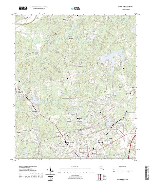
2024 Map of Newnan North
USGS Topo · Published 2024About this map
The Chattahoochee River defines the northern limit of this landscape, where the border between Carroll and Coweta Counties follows the water's course. Just south of the river, the area transitions into a complex network of creeks and small settlements including Roscoe, Sargent, and Arnco Mills. The presence of numerous historic cemeteries, such as the Oak Grove Baptist Church Cem and Wesley Chapel African Methodist Episcopal Cem, provides a detailed record of the region's communal and religious foundations.
Find a feature on this map
241 named features on this map. Tap any name to fly to it.
Don’t see what you’re looking for? This feature index may not catch every label — zoom into the map to look around manually.
Map Details
Editions of this 2024 Newnan North Map
This is the sole edition of this map. No revisions or reprints were ever made.
Other maps of this area

1891 · Marietta
USGS Topo · 1:125,000

1895 · Marietta
USGS Topo · 1:125,000

1897 · Marietta
USGS Topo · 1:125,000

1901 · Marietta
USGS Topo · 1:125,000

1953 · Atlanta
USGS Topo · 1:250,000

1954 · Palmetto
USGS Topo · 1:24,000

1957 · Atlanta
USGS Topo · 1:250,000

1958 · Rico
USGS Topo · 1:24,000

1958 · Atlanta
USGS Topo · 1:250,000
1958 · Villa Rica
USGS Topo · 1:62,500