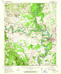
1962 Map of Newport
USGS Topo · Published 1967About this map
The White River carves a complex path through this segment of the Arkansas Delta, creating an intricate system of oxbows and backwaters like Horseshoe Lake, Wall Lake, and the winding Cravens Chute. The town of Newport serves as a regional anchor, with the Missouri Pacific railroad line connecting it to surrounding communities such as Diaz, Campbell Station, and Olyphant. In the northwestern corner, the terrain rises toward Surrounded Hill and Bailey Hill, contrasting with the low-lying wetlands and brakes that dominate the central river corridor.
Find a feature on this map
122 named features on this map. Tap any name to fly to it.
Don’t see what you’re looking for? This feature index may not catch every label — zoom into the map to look around manually.
Map Details
Editions of this 1962 Newport Map
This is the sole edition of this map. No revisions or reprints were ever made.
Other maps of this area

1890 · Batesville
USGS Topo · 1:125,000

1891 · Batesville
USGS Topo · 1:125,000

1932 · Strawberry
USGS Topo · 1:62,500

1935 · Alicia
USGS Topo · 1:62,500

1935 · Strawberry
USGS Topo · 1:62,500

1935 · Newport
USGS Topo · 1:62,500

1935 · Augusta
USGS Topo · 1:62,500

1935 · Tuckerman
USGS Topo · 1:62,500

1935 · Bald Knob
USGS Topo · 1:62,500

1940 · Tilton
USGS Topo · 1:62,500