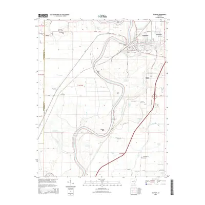
2014 Map of Newport
USGS Topo · Published 2014About this map
The White River carves a winding path through this corner of Jackson County, shaping the landscape with its dramatic oxbows and named river features like Hinkle Bend, Mason Bend, and Stalcup Bend. The city of Newport serves as the regional hub, situated on the river's eastern bank where the Newport Bridge connects the urban center to the rural west. The township structure is defined by a series of smaller settlements and historical clusters such as Nuckles, Macks, and Island Town.
Find a feature on this map
159 named features on this map. Tap any name to fly to it.
Don’t see what you’re looking for? This feature index may not catch every label — zoom into the map to look around manually.
Map Details
Editions of this 2014 Newport Map
This is the sole edition of this map. No revisions or reprints were ever made.
Other maps of this area

1935 · Newport
USGS Topo · 1:62,500

1935 · Augusta
USGS Topo · 1:62,500

1935 · Tuckerman
USGS Topo · 1:62,500

1940 · Tilton
USGS Topo · 1:62,500

1953 · Memphis
USGS Topo · 1:250,000

1956 · Memphis
USGS Topo · 1:250,000

1956 · Tilton
USGS Topo · 1:62,500
1956 · Newark
USGS Topo · 1:24,000

1957 · Augusta
USGS Topo · 1:62,500

1962 · Jacksonport
USGS Topo · 1:24,000