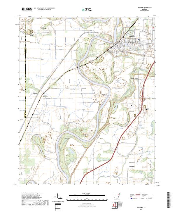
2024 Map of Newport
USGS Topo · Published 2024About this map
The White River defines the winding geography of this region, creating a complex network of oxbows, sloughs, and bars that have long dictated local settlement. On the river's eastern bank, the town of Newport serves as a central hub, anchored by the Jackson County Courthouse. The surrounding landscape is characterized by its alluvial nature, featuring numerous water bodies such as Horseshoe Lake, Vance Lake, and Grassy Lake, along with distinctive river features like Hinkle Bend and Towhead Island.
Find a feature on this map
103 named features on this map. Tap any name to fly to it.
Don’t see what you’re looking for? This feature index may not catch every label — zoom into the map to look around manually.
Map Details
Editions of this 2024 Newport Map
This is the sole edition of this map. No revisions or reprints were ever made.
Other maps of this area

1935 · Newport
USGS Topo · 1:62,500

1935 · Augusta
USGS Topo · 1:62,500

1935 · Tuckerman
USGS Topo · 1:62,500

1940 · Tilton
USGS Topo · 1:62,500

1953 · Memphis
USGS Topo · 1:250,000

1956 · Memphis
USGS Topo · 1:250,000

1956 · Tilton
USGS Topo · 1:62,500
1956 · Newark
USGS Topo · 1:24,000

1957 · Augusta
USGS Topo · 1:62,500

1962 · Jacksonport
USGS Topo · 1:24,000