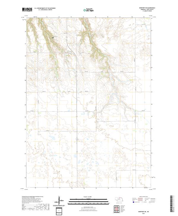
2021 Map of Newport NE
USGS Topo · Published 2021About this map
Kirkwood Cem stands as a primary landmark in this rural section of Rock County, serving as a point of reference for researchers tracing the early families of the Nebraska Sandhills. The landscape is defined by the ephemeral flow of several waterways, including Oak Cr, Ash Cr, and Otter Cr, which carve through the terrain and influence the placement of the local section lines. This 2021 survey documents the grid of section roads that provide access to this ranching country, such as Amber Rd and Hay Rd. These corridors follow the established township boundaries of t32n r18w, t32n r17w, t31n r18w, and t31n r17w. The map provides a clear view of the sparse rural infrastructure and natural drainage patterns that have shaped land use in this part of north-central Nebraska for generations.
Find a feature on this map
23 named features on this map. Tap any name to fly to it.
Don’t see what you’re looking for? This feature index may not catch every label — zoom into the map to look around manually.
Map Details
Editions of this 2021 Newport NE Map
This is the sole edition of this map. No revisions or reprints were ever made.
Other maps of this area

1949 · Jamison SW
USGS Topo · 1:24,000

1949 · Carns
USGS Topo · 1:24,000

1950 · Carns
USGS Topo · 1:24,000

1950 · Mariaville
USGS Topo · 1:24,000

1951 · Jamison SW
USGS Topo · 1:24,000

1951 · Naper SW
USGS Topo · 1:24,000

1954 · Stuart
USGS Topo · 1:24,000

1954 · Stuart NW
USGS Topo · 1:24,000

1954 · Newport NE
USGS Topo · 1:24,000

1954 · Newport
USGS Topo · 1:24,000