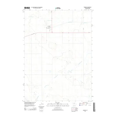
2014 Map of Newport
USGS Topo · Published 2014About this map
Newport sits as a primary settlement in this northern Nebraska landscape, organized around a small grid including Cedar St, Main St, and Mt Vernon St. The town's civic center is marked by the Post Office, which serves as a central point of reference for local family history research. The surrounding terrain is defined by the hydrological divide of the Elkhorn River system, with the N Br Elkhorn River flowing north of the townsite and the S Fork Elkhorn River winding through the southern half of the quadrangle. Significant transportation corridors intersect here, including Us-20 and Ne-137, which facilitate movement through this cattle-country region. To the southeast, the drainage of Dry Cr indicates the subtle shifts in elevation that characterize the local topography.
Find a feature on this map
12 named features on this map. Tap any name to fly to it.
Don’t see what you’re looking for? This feature index may not catch every label — zoom into the map to look around manually.
Map Details
Editions of this 2014 Newport Map
This is the sole edition of this map. No revisions or reprints were ever made.
Other maps of this area

1949 · Carns
USGS Topo · 1:24,000

1950 · Carns
USGS Topo · 1:24,000

1954 · Stuart
USGS Topo · 1:24,000

1954 · Stuart NW
USGS Topo · 1:24,000

1954 · Newport NE
USGS Topo · 1:24,000

1954 · Newport
USGS Topo · 1:24,000

1954 · Newport SW
USGS Topo · 1:24,000

1955 · O'Neill
USGS Topo · 1:250,000

1959 · O'Neill
USGS Topo · 1:250,000

1969 · O'Neill
USGS Topo · 1:250,000