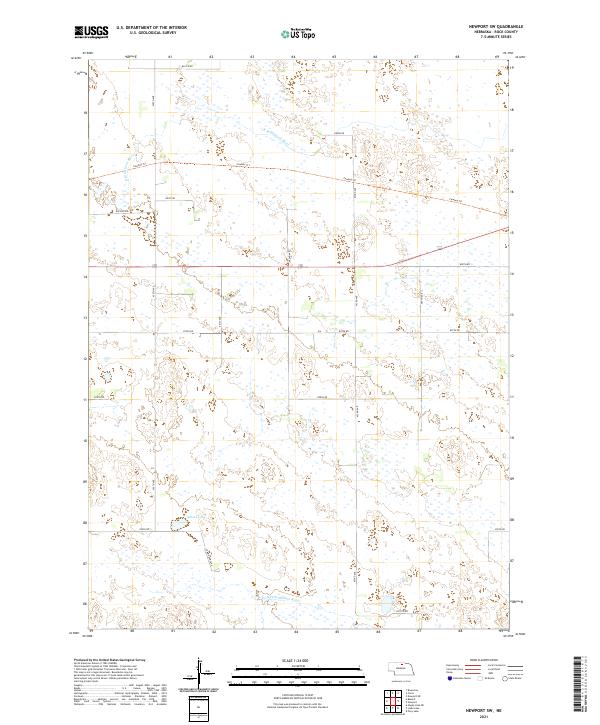
2021 Map of Newport SW
USGS Topo · Published 2021About this map
The N Br Elkhorn River and S Fork Elkhorn River define the hydrology of this Rock County landscape, which transitions between riverine drainage and the scattered wetlands typical of the Nebraska Sandhills. The terrain is structured by a rectilinear grid of section roads, including 876th Rd and 881st Rd, though the natural topography often interrupts this geometry with small, unnamed ponds and seasonal basins. A primary lateral thoroughfare, the Cowboy Trl, cuts across the northern half of the region, following a former rail alignment that once connected small agricultural hubs. To the south, Adams Lake sits as a prominent water feature amidst the township lines of t30n r19w and t29n r18w. This 2021 survey documents the modern ranching infrastructure, from Buffalo Rd to Coyote Rd, illustrating how land use remains tied to the ancient paths of the Elkhorn forks.
Find a feature on this map
19 named features on this map. Tap any name to fly to it.
Don’t see what you’re looking for? This feature index may not catch every label — zoom into the map to look around manually.
Map Details
Editions of this 2021 Newport SW Map
This is the sole edition of this map. No revisions or reprints were ever made.
Other maps of this area

1949 · Riverview
USGS Topo · 1:24,000

1949 · Carns
USGS Topo · 1:24,000

1950 · Carns
USGS Topo · 1:24,000

1950 · Riverview
USGS Topo · 1:24,000

1954 · Newport NE
USGS Topo · 1:24,000

1954 · Bassett
USGS Topo · 1:24,000

1954 · Newport
USGS Topo · 1:24,000

1954 · Newport SW
USGS Topo · 1:24,000

1955 · O'Neill
USGS Topo · 1:250,000

1959 · O'Neill
USGS Topo · 1:250,000