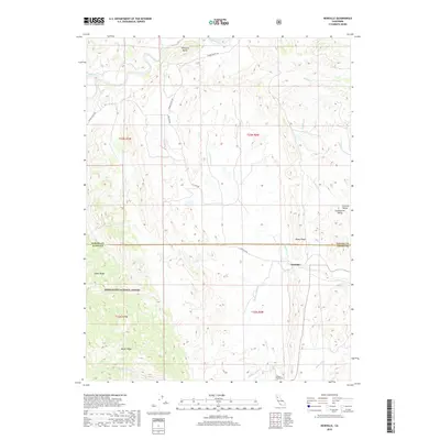
2018 Map of Newville
USGS Topo · Published 2018About this map
Newville sits at the eastern edge of the foothills where the Sacramento Valley meets the rising terrain of the North Coast Ranges. This landscape is defined by its drainage systems, including the N Fork Stony Cr and Thomes Cr, which have carved out the varied ridges of the region. The transition from the flat Central Valley to the protected lands of the Mendocino National Forest is marked by distinctive topographical landmarks such as Williams Butte, Rocky Ridge, and Digger Ridge.
Find a feature on this map
27 named features on this map. Tap any name to fly to it.
Don’t see what you’re looking for? This feature index may not catch every label — zoom into the map to look around manually.
Map Details
Editions of this 2018 Newville Map
This is the sole edition of this map. No revisions or reprints were ever made.
Other maps of this area

1919 · Fruto
USGS Topo · 1:62,500

1919 · Elk Creek
USGS Topo · 1:62,500

1944 · Fruto
USGS Topo · 1:62,500

1944 · Flournoy
USGS Topo · 1:62,500

1948 · Elk Creek
USGS Topo · 1:62,500

1952 · Paskenta
USGS Topo · 1:62,500

1957 · Elk Creek
USGS Topo · 1:62,500

1957 · Ukiah
USGS Topo · 1:250,000
1958 · Fruto
USGS Topo · 1:62,500
1958 · Flournoy
USGS Topo · 1:62,500