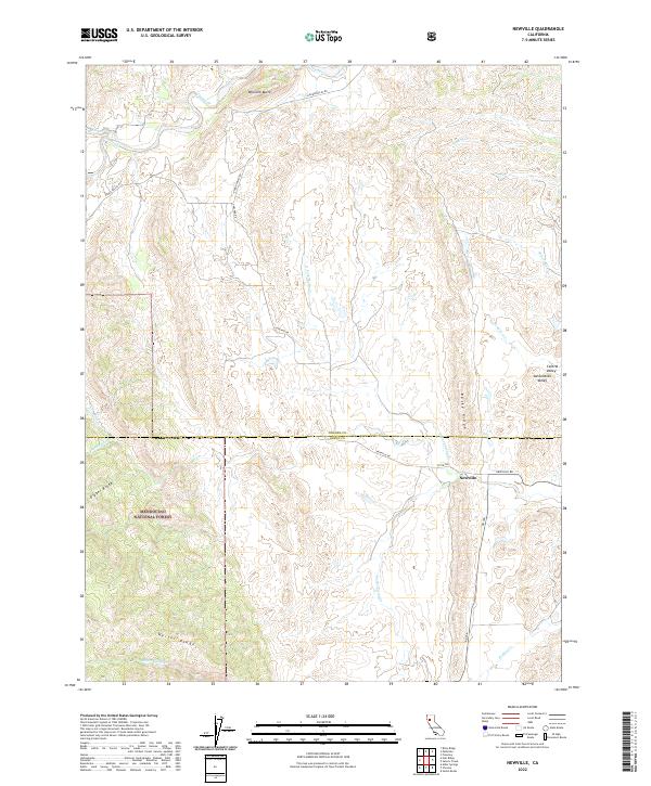
2022 Map of Newville
USGS Topo · Published 2022About this map
Newville sits at the eastern edge of the interior Coast Range where the foothills meet the Central Valley. This area is characterized by a series of prominent northwest-trending geological structures, including Rocky Ridge, Digger Ridge, and Heifer Ridge. The transition from the rugged highlands of the Mendocino National Forest to the flatlands of the Sacramento Valley is marked by numerous watercourses such as Thomes Cr and Salt Cr that drain toward the valley floor. Transportation across this rural landscape relies on historic routes like Round Valley Rd and Newville Rd, which follow the natural contours of the terrain. The map also records the boundary between Tehama and Glenn counties, illustrating how political lines were drawn through this topographically complex region of Northern California.
Find a feature on this map
28 named features on this map. Tap any name to fly to it.
Don’t see what you’re looking for? This feature index may not catch every label — zoom into the map to look around manually.
Map Details
Editions of this 2022 Newville Map
This is the sole edition of this map. No revisions or reprints were ever made.
Other maps of this area

1919 · Fruto
USGS Topo · 1:62,500

1919 · Elk Creek
USGS Topo · 1:62,500

1944 · Fruto
USGS Topo · 1:62,500

1944 · Flournoy
USGS Topo · 1:62,500

1948 · Elk Creek
USGS Topo · 1:62,500

1952 · Paskenta
USGS Topo · 1:62,500

1957 · Elk Creek
USGS Topo · 1:62,500

1957 · Ukiah
USGS Topo · 1:250,000
1958 · Fruto
USGS Topo · 1:62,500
1958 · Flournoy
USGS Topo · 1:62,500