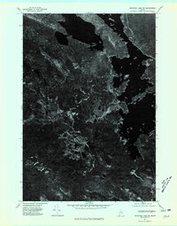
1975 Map of Nicatous Lake SW
USGS Topo · Published 1980About this map
Quagus dominates the central-western portion of this orthophotoquad, an area of the Maine woods defined by its dense forest canopy and intricate water systems. Produced from aerial photography taken in November 1975, the map reveals the stark, unvarnished texture of the landscape as it appeared just before the onset of winter. The dark, sprawling patterns of the timberland are interrupted only by the deep, irregular shapes of lakes and the narrow, winding paths of drainage streams. This specific format of photography provides a literal view of the vegetation density and shoreline geometry of the Quagus area, offering a precise visual baseline for land-use researchers or those interested in the historical conservation state of the Hancock County backcountry.
Find a feature on this map
1 named feature on this map. Tap any name to fly to it.
Don’t see what you’re looking for? This feature index may not catch every label — zoom into the map to look around manually.
Map Details
Editions of this 1975 Nicatous Lake SW Map
This is the sole edition of this map. No revisions or reprints were ever made.
Other maps of this area

1929 · Great Pond
USGS Topo · 1:48,000

1929 · Lead Mountain
USGS Topo · 1:48,000

1931 · Saponac
USGS Topo · 1:48,000

1932 · Nicatous Lake
USGS Topo · 1:48,000

1932 · Lead Mountain
USGS Topo · 1:62,500

1932 · Great Pond
USGS Topo · 1:62,500

1934 · Saponac
USGS Topo · 1:62,500

1934 · Nicatous Lake
USGS Topo · 1:62,500

1948 · Bangor
USGS Topo · 1:250,000

1954 · Millinocket
USGS Topo · 1:250,000