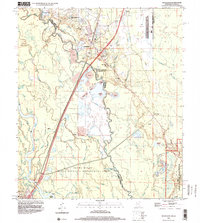
1998 Map of Nicholson
USGS Topo · Published 2000About this map
The Pearl River dominates this landscape along the border of Mississippi and Louisiana, creating a complex network of bayous, sloughs, and lakes. This 1998 survey shows the dense riparian environment of the Pearl River State Wildlife Management Area, where features like Lindsey Lake and Murdock Eddy Lake sit within a labyrinth of waterways including Indian Bayou and Bogue Chitto. The map documents the shifting nature of the river with numerous sandpits and gravel operations concentrated near Nicholson.
Find a feature on this map
66 named features on this map. Tap any name to fly to it.
Don’t see what you’re looking for? This feature index may not catch every label — zoom into the map to look around manually.
Map Details
Editions of this 1998 Nicholson Map
2 editions found
Other maps of this area

1914 · Nicholson
USGS Topo · 1:62,500

1921 · Nicholson
USGS Topo · 1:62,500

1935 · Slidell
USGS Topo · 1:62,500

1939 · Slidell
USGS Topo · 1:62,500

1941 · Honey Island
USGS Topo · 1:31,680

1942 · Walkiah Bluff
USGS Topo · 1:31,680

1950 · Haaswood
USGS Topo · 1:31,680

1950 · Slidell
USGS Topo · 1:62,500

1953 · Mobile
USGS Topo · 1:250,000

1954 · Haaswood
USGS Topo · 1:31,680