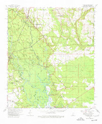
1959 Map of Nicholson
USGS Topo · Published 1977About this map
The complex marshes and bayous of the Pearl River divide Mississippi and Louisiana in this 1950s survey, illustrating a landscape defined by its waterways. Along the eastern bank in Hancock County, settlements like Logtown and Pearlington sit amidst a network of intricate drainage systems including Indian Bayou and Turkey Bayou. The Southern Railway corridor anchors the northern reach near Nicholson, while the southern wetlands are marked by isolated family-named landmarks and remote landings such as Davis Landing and Gum Bayou Landing.
Find a feature on this map
97 named features on this map. Tap any name to fly to it.
Don’t see what you’re looking for? This feature index may not catch every label — zoom into the map to look around manually.
Map Details
Editions of this 1959 Nicholson Map
3 editions found
Other maps of this area

1892 · Chef Menteur
USGS Topo · 1:62,500

1893 · Rigolets
USGS Topo · 1:62,500

1893 · Toulme
USGS Topo · 1:62,500

1914 · Nicholson
USGS Topo · 1:62,500

1921 · Nicholson
USGS Topo · 1:62,500

1935 · Slidell
USGS Topo · 1:62,500

1935 · English Lookout
USGS Topo · 1:31,680

1935 · Grand Island Pass
USGS Topo · 1:31,680

1936 · North Shore
USGS Topo · 1:31,680

1936 · Chef Menteur
USGS Topo · 1:62,500