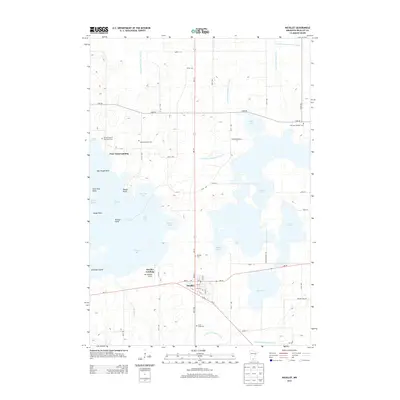
2013 Map of Nicollet
USGS Topo · Published 2013About this map
Nicollet anchors this agricultural and lacustrine landscape, where the town grid meets the junction of Us-14 and MN-99. The surrounding terrain is defined by the expansive and complex shoreline of Swan Lake, characterized by numerous named features such as Nicollet Bay, Peterson Bay, and Goose Point. This 2013 survey provides a detailed record of the region's managed waterways, illustrated by an extensive network of drainage infrastructure including County Ditch Number Seventy-eight and County Ditch Number Seventy-six. Genealogical interest is particularly high here, with several distinct burial sites including the Nicollet County Poor Farm Cem and the Mid Lake Catholic Cem. The map also captures local transportation and recreation points such as Hay Shakers Airport and the boat access at Poor Farm Landing, showing how the community interacts with the surrounding wetlands and prairie of Nicollet County.
Find a feature on this map
63 named features on this map. Tap any name to fly to it.
Don’t see what you’re looking for? This feature index may not catch every label — zoom into the map to look around manually.
Map Details
Editions of this 2013 Nicollet Map
This is the sole edition of this map. No revisions or reprints were ever made.
Other maps of this area

1951 · Mankato West
USGS Topo · 1:62,500

1953 · New Ulm
USGS Topo · 1:250,000

1957 · New Ulm
USGS Topo · 1:250,000

1958 · New Ulm
USGS Topo · 1:250,000

1964 · Bernadotte
USGS Topo · 1:24,000

1964 · Courtland
USGS Topo · 1:24,000

1965 · Norseland
USGS Topo · 1:24,000

1965 · New Sweden
USGS Topo · 1:24,000

1965 · North Star
USGS Topo · 1:24,000

1965 · Cambria
USGS Topo · 1:24,000