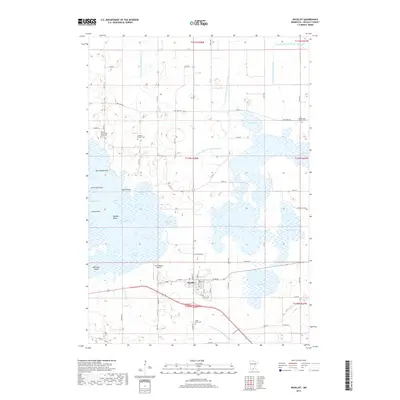
2019 Map of Nicollet
USGS Topo · Published 2019About this map
The town of Nicollet serves as the focal point of this 2019 survey, positioned at the intersection of Us HWY 14 and several rural county routes. The surrounding landscape is dominated by a complex network of wetlands and open water, most notably the expansive Swan Lake, which is segmented into distinct basins such as Nicollet Bay, Johnson Bay, and Peterson Bay. These aquatic features are further defined by landmarks like Dahlman Island and several named points, including Breezy Point and Lone Tree Point. The mapping of numerous drainage ditches, such as County Ditch Number Seventy-six, illustrates the extensive water management systems required for the region's agricultural productivity.
Find a feature on this map
85 named features on this map. Tap any name to fly to it.
Don’t see what you’re looking for? This feature index may not catch every label — zoom into the map to look around manually.
Map Details
Editions of this 2019 Nicollet Map
This is the sole edition of this map. No revisions or reprints were ever made.
Other maps of this area

1951 · Mankato West
USGS Topo · 1:62,500

1953 · New Ulm
USGS Topo · 1:250,000

1957 · New Ulm
USGS Topo · 1:250,000

1958 · New Ulm
USGS Topo · 1:250,000

1964 · Bernadotte
USGS Topo · 1:24,000

1964 · Courtland
USGS Topo · 1:24,000

1965 · Norseland
USGS Topo · 1:24,000

1965 · New Sweden
USGS Topo · 1:24,000

1965 · North Star
USGS Topo · 1:24,000

1965 · Cambria
USGS Topo · 1:24,000