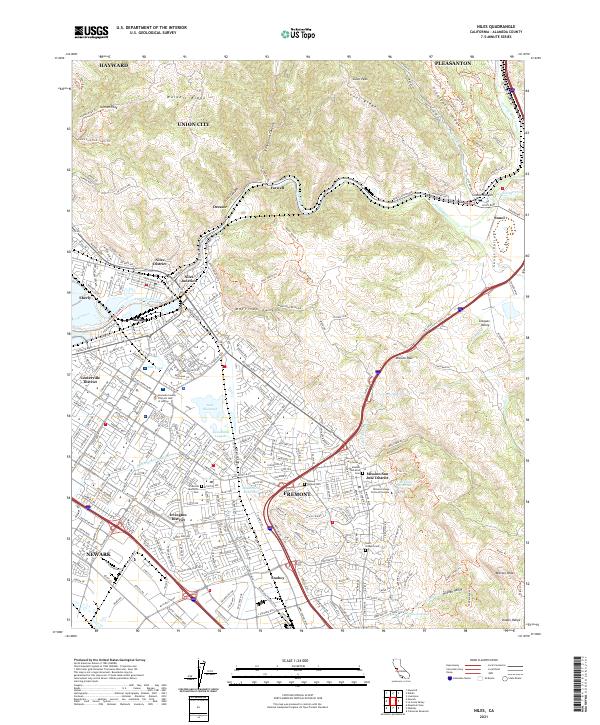
2021 Map of Niles
USGS Topo · Published 2021About this map
The Diablo Range dominates the eastern landscape, where Sunol Peak and Walpert Ridge overlook a complex network of canyons and valleys. The drainage of Alameda Creek carves through Niles Canyon, a vital corridor historically occupied by the California Eastern RR. This modern survey illustrates the dense suburban integration of Fremont, Newark, and Union City, while preserving the distinct identities of older enclaves like the Niles District and the Mission San Jose District.
Find a feature on this map
281 named features on this map. Tap any name to fly to it.
Don’t see what you’re looking for? This feature index may not catch every label — zoom into the map to look around manually.
Map Details
Editions of this 2021 Niles Map
This is the sole edition of this map. No revisions or reprints were ever made.
Other maps of this area

1889 · San Jose
USGS Topo · 1:62,500

1897 · San Jose
USGS Topo · 1:62,500

1897 · Palo Alto
USGS Topo · 1:62,500

1899 · San Jose
USGS Topo · 1:62,500

1899 · Palo Alto
USGS Topo · 1:62,500

1899 · Haywards
USGS Topo · 1:62,500

1902 · Santa Cruz
USGS Topo · 1:125,000

1906 · Pleasanton
USGS Topo · 1:62,500

1915 · Haywards
USGS Topo · 1:62,500

1941 · Pleasanton
USGS Topo · 1:62,500