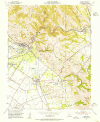
1953 Map of Niles
USGS Topo · Published 1955About this map
Mission San Jose and the surrounding agricultural valleys are the focal point of this mid-century landscape, where the transit lines of the Southern Pacific and Western Pacific railroads converge. The map documents a significant intersection of early California history and modern utility, featuring the historic Mission San Jose de Guadalupe alongside massive infrastructure like the Hetch Hetchy Aqueduct. The area around Niles shows the industrial footprint of the era, including a prominent Pottery Plant and extensive Gravel Pits near the banks of Alameda Creek.
Find a feature on this map
55 named features on this map. Tap any name to fly to it.
Don’t see what you’re looking for? This feature index may not catch every label — zoom into the map to look around manually.
Map Details
Editions of this 1953 Niles Map
This is the sole edition of this map. No revisions or reprints were ever made.
Other maps of this area

1889 · San Jose
USGS Topo · 1:62,500

1897 · San Jose
USGS Topo · 1:62,500

1897 · Palo Alto
USGS Topo · 1:62,500

1899 · San Jose
USGS Topo · 1:62,500

1899 · Palo Alto
USGS Topo · 1:62,500

1899 · Haywards
USGS Topo · 1:62,500

1902 · Santa Cruz
USGS Topo · 1:125,000

1906 · Pleasanton
USGS Topo · 1:62,500

1915 · Haywards
USGS Topo · 1:62,500

1941 · Pleasanton
USGS Topo · 1:62,500