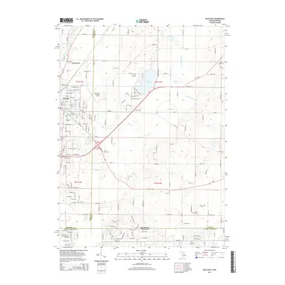
2014 Map of Niles East
USGS Topo · Published 2014About this map
Niles and North Niles sit at the western edge of this 2014 survey, where the urban grid meets the agricultural landscape of the Michigan-Indiana border. The Dowagiac River cuts through the northwest corner, while the eastern half of the sheet is defined by glacial features like Barron Lake and Mudd Lake. This transition from the structured street plan of the city to the irregular drainage of the Mudd Lake Drain and Brandywine Creek illustrates the enduring influence of the local hydrology on development. Genealogists and local historians can find several established burial grounds scattered across the townships, including Springbrook Cemetery near the city center and the rural Smith Chapel Cemetery to the southeast. The presence of the Jerry Tyler Memorial Airport and the complex interchange near Brandywine Creek highlight the area's role as a regional transit hub.
Find a feature on this map
177 named features on this map. Tap any name to fly to it.
Don’t see what you’re looking for? This feature index may not catch every label — zoom into the map to look around manually.
Map Details
Editions of this 2014 Niles East Map
This is the sole edition of this map. No revisions or reprints were ever made.
Other maps of this area

1927 · Niles
USGS Topo · 1:62,500

1930 · Niles
USGS Topo · 1:62,500

1943 · Niles
USGS Topo · 1:62,500

1945 · Cassopolis
USGS Topo · 1:62,500

1947 · Cassopolis
USGS Topo · 1:62,500

1953 · Chicago
USGS Topo · 1:250,000

1957 · Chicago
USGS Topo · 1:250,000

1958 · South Bend East
USGS Topo · 1:24,000

1958 · South Bend West
USGS Topo · 1:24,000

1958 · Osceola
USGS Topo · 1:24,000