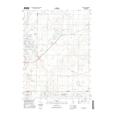
2017 Map of Niles East
USGS Topo · Published 2017About this map
Niles and Granger straddle the state line in this contemporary record of the Michigan-Indiana borderlands. The landscape is defined by the winding course of the Dowagiac River and a collection of glacial lakes including Barron Lake and Goose Lake. Significant for local history and genealogy, the map identifies numerous burial grounds such as Dick Cem, Truitt Cem, and Smith Chapel Cem scattered across the rural township sections. The northern edge of the survey features the Jerry Tyler Memorial Airport, marking the expansion of infrastructure near the Berrien and Cass County line. Modern transit corridors like Detroit Rd and the dense street grid of eastern Niles show the continued development of this cross-border region, while the persistence of family-named sites like Coulter Chapel Cem provides a bridge to the area's pioneer past.
Find a feature on this map
180 named features on this map. Tap any name to fly to it.
Don’t see what you’re looking for? This feature index may not catch every label — zoom into the map to look around manually.
Map Details
Editions of this 2017 Niles East Map
This is the sole edition of this map. No revisions or reprints were ever made.
Other maps of this area

1927 · Niles
USGS Topo · 1:62,500

1930 · Niles
USGS Topo · 1:62,500

1943 · Niles
USGS Topo · 1:62,500

1945 · Cassopolis
USGS Topo · 1:62,500

1947 · Cassopolis
USGS Topo · 1:62,500

1953 · Chicago
USGS Topo · 1:250,000

1957 · Chicago
USGS Topo · 1:250,000

1958 · South Bend East
USGS Topo · 1:24,000

1958 · South Bend West
USGS Topo · 1:24,000

1958 · Osceola
USGS Topo · 1:24,000